Books & maps
Books
All of the books listed below are written about, or make reference to, in a serious way, the Macclesfield Canal. Some may no longer be in print but could possibly be found in second hand book shops and sales. For those available from the IWA click the IWA shop link at the end of the description for the current price and availability.
The Macclesfield & Upper Peak Forest Canals Guide
This edition of our popular guide (cover shown left) is for bedtime reading with a description of the canal and its local environment, plus considerable detail for boaters on shops, pubs and services, together with maps which are also suitable for road users. Including the Upper Peak Forest Canal. Now out of print, please see the media page for full details.
|
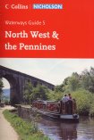 Nicholson Ordnance Survey Guide to the Waterways, volume 5, North West & the Pennines - popular spiral bound boating guide. IWA bookshop. Nicholson Ordnance Survey Guide to the Waterways, volume 5, North West & the Pennines - popular spiral bound boating guide. IWA bookshop.
|
 Inland Waterways of Great Britain L. A. Edwards - modern definitive description of the waterway infrastructure including the Macclesfield Canal. Latest acclaimed edition edited by Jane Cumberlidge. A must for any serious waterway enthusiast. IWA bookshop. Inland Waterways of Great Britain L. A. Edwards - modern definitive description of the waterway infrastructure including the Macclesfield Canal. Latest acclaimed edition edited by Jane Cumberlidge. A must for any serious waterway enthusiast. IWA bookshop.
|
 The Illustrated History of Canal and River Navigations Edward Paget-Tomlinson - a short history on every canal including the Macclesfield Canal. Also available in paper back. IWA bookshop. The Illustrated History of Canal and River Navigations Edward Paget-Tomlinson - a short history on every canal including the Macclesfield Canal. Also available in paper back. IWA bookshop.
|
 Britain's Waterways - a Unique Insight - one of the excellent GEOprojects productions. While covering every British waterway the Macclesfield Canal gets most of page 60 including a good location map. Highly recommended with high quality maps. See also their Macclesfield Canal map below. IWA bookshop. Britain's Waterways - a Unique Insight - one of the excellent GEOprojects productions. While covering every British waterway the Macclesfield Canal gets most of page 60 including a good location map. Highly recommended with high quality maps. See also their Macclesfield Canal map below. IWA bookshop.
|
 Pearson's Canal Companions, Cheshire Ring & Wigan Pier - boating guide. Very popular with boaters. May well be out of print - not listed at Amazon. May well be updated in near future - check that you are getting the latest edition. IWA bookshop. Pearson's Canal Companions, Cheshire Ring & Wigan Pier - boating guide. Very popular with boaters. May well be out of print - not listed at Amazon. May well be updated in near future - check that you are getting the latest edition. IWA bookshop.
|
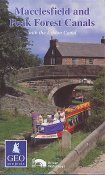 GEO projects map of the Macclesfield and Peak Forest Canals, an excellent map published in April 2001. IWA bookshop. GEO projects map of the Macclesfield and Peak Forest Canals, an excellent map published in April 2001. IWA bookshop.
|
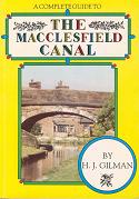 The Macclesfield Canal H.J. Gilman - towpath guide for all users. A lot of text with information on a wide range of aspects. Place name, bridge name and pub indexes. The pub list provides a short description (valid 1992). Useful for reference purposes. The Macclesfield Canal H.J. Gilman - towpath guide for all users. A lot of text with information on a wide range of aspects. Place name, bridge name and pub indexes. The pub list provides a short description (valid 1992). Useful for reference purposes.
|
 The Canals of the West Midlands Charles Hadfield - the definitive history of the west midlands canals including the Macclesfield. Only available secon hand. A new and more detailed history of the Macclesfield Canal is presently being written by historian members of the canal society. The Canals of the West Midlands Charles Hadfield - the definitive history of the west midlands canals including the Macclesfield. Only available secon hand. A new and more detailed history of the Macclesfield Canal is presently being written by historian members of the canal society.
|
 Bradshaw's Canals & Navigable Rivers Henry Rodolph de Salis 1904 - historical definitive description of the waterway infrastructure. The Macclesfield is in section 39c1, the Great Central Railway, who owned the canal in the early part of the 20th century. Only available second hand. This was the precursor to Edwards' Inland Waterways of Great Britain - see above. Historically very interesting. Bradshaw's Canals & Navigable Rivers Henry Rodolph de Salis 1904 - historical definitive description of the waterway infrastructure. The Macclesfield is in section 39c1, the Great Central Railway, who owned the canal in the early part of the 20th century. Only available second hand. This was the precursor to Edwards' Inland Waterways of Great Britain - see above. Historically very interesting.
|
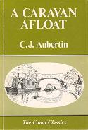 A Caravan Afloat C. J. Aubertin - delightful story of a canal trip taken, in part, on the Macclesfield and Peak Forest Canals in 1916; very enjoyable read. Republished by Shepperton Swan. A Caravan Afloat C. J. Aubertin - delightful story of a canal trip taken, in part, on the Macclesfield and Peak Forest Canals in 1916; very enjoyable read. Republished by Shepperton Swan.
|
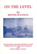 On The Level Dennis Suleman - the history and development of the upper levels of the Macclesfield and Peak Forest canals. Available from the North Cheshire Cruising Club. On The Level Dennis Suleman - the history and development of the upper levels of the Macclesfield and Peak Forest canals. Available from the North Cheshire Cruising Club.
|
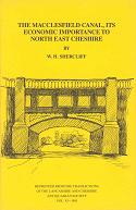 The Macclesfield Canal - Its economic importance to North East Cheshire W. H. Shercliff, in Transactions of the Lancashire and Cheshire Antiquarian Society, 1985, pp.86-124. A technical tome giving a great deal of interesting information about the commercial history of the canal. The Macclesfield Canal - Its economic importance to North East Cheshire W. H. Shercliff, in Transactions of the Lancashire and Cheshire Antiquarian Society, 1985, pp.86-124. A technical tome giving a great deal of interesting information about the commercial history of the canal.
|
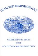 Diamond Reminiscences - Stories from 60 years of the North Cheshire Cruising Club, based for all that time in the High Lane arm. Available from the North Cheshire Cruising Club. Diamond Reminiscences - Stories from 60 years of the North Cheshire Cruising Club, based for all that time in the High Lane arm. Available from the North Cheshire Cruising Club.
|
Poynton A Coalmining Village - social history, transport and industry 1700 - 1939 by W. H. Shercliff, D. A. Kitching and J. M. Ryan. Though mainly relating to the mining industry, this interestingly illustrated book contains references to the canal which was so important to the industry before the railways were built. No longer easily obtained - try second hand shops, sales, etc. Much more information on this interesting area can be found in Dave Kitching's pages. |
Poynton A Thriving Community, 1946-83 - a sequel to the social history, transport and industry of this Cheshire town by W. H. Shercliff, D. A. Kitching and J. M. Ryan. Contains three pages of special interest to canal history enthusiasts. Published in 1996. Becoming difficult to find. |
Cheshire Ring Walk - sections 1, 2 and 3 of this multi-part walking guide cover the Macclesfield Canal. They provide a map with a description of what can be seen from the towing path. Published by Cheshire County Council in 1987. They are now very hard to find. |
Walks Around Bollington - an extremely popular folded guide to a dozen walks in the Bollington area. The walks are a mixture of hills and lowlands taking in most of the notable views, buildings and industrial archaeology of the area, including the canal and its mills. Available from Bollington Discovery Centre, the Drop-in Centre, Town Hall, local newsagents and book sellers. |
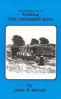 Canal Walk Guides Vol 4: The Cheshire Ring John N. Merrill - a walkers guide. [See also our pages on walks from the Macclesfield Canal]. Canal Walk Guides Vol 4: The Cheshire Ring John N. Merrill - a walkers guide. [See also our pages on walks from the Macclesfield Canal].
|
Further, you may care to checkout Dave Kitching's bibliography of local canals.
Maps
These maps cover the Macclesfield Canal:
- OS 1:50,000 Landranger sheet 109 Manchester covers Marple to br.22 (Adlington)
- OS 1:50,000 Landranger sheet 118 Stoke-on-Trent & Macclesfield area covers br.22 (Adlington) to Kidsgrove
- OS 1:25,000 Explorer sheet 268 Wilmslow, Macclesfield & Congleton covers the entire canal - the map is two sided divided north and south
- OS 1:25,000 Explorer sheet 258 Stoke-on-Trent & Newcastle-under-Lyme covers a short section at the bottom end from br.83 (Moreton) to Kidsgrove as well as the Trent & Mersey canal from Thurlwood to Burston near Sandon and the Caldon Canal from Etruria to Consall Forge
- OS 1:25,000 series sheets SJ98, SJ97, SJ96, SJ86, SJ85 (replaced first by Pathfinder series and now by Explorer series)
- OS 1:25,000 Pathfinder sheets 741, 759, 776, 792 (now replaced by Explorer series)
- A-Z Manchester Street Atlas covers Marple to near br.18 (Lane Ends, Adlington)
- OS Cheshire Street Atlas covers from br.10 (High Lane) to Kidsgrove
GEO projects Macclesfield and Peak Forest Canals with the Ashton Canal published April 2001, this map is one of the outstanding colour maps of the waterways based on OS 1:60,000 maps of the canal corridor (see Books above).
A narrow map of the Macclesfield Canal is provided in Nicholson The Ordnance Survey Guide to the Waterways volume 5 North West & the Pennines, together with their towpath guide (see Books above).
A simple route map is also provided in The Macclesfield Canal Society's leaflet guide to the canal. The most up to date version of this is available online. A different strip map, of a more general nature, is included in the society's The Macclesfield & Upper Peak Forest Canals Guide (see Books above).
|