Congleton Hightown
Buglawton to Congleton Hightown
 Just
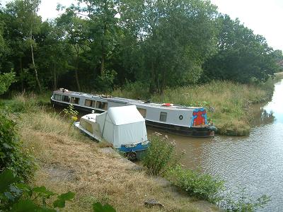
south of Porters Farm Bridge, no. 72, notice the boat length branch
known as Vaudrey's wharf (left).
Originally a wharf serving a nearby cotton mill, it subsequently
provided a canal/railway interchange when the Biddulph Line was active.
Today the wharf is at serious risk of being lost due to leakage and
ownership problems. Please see the page
dedicated to this problem. The railway track bed is now part
of the district's extensive footpath network being the northern end
of the Mow Cop Trail which, a mile away, shares part of the course
of the Staffordshire Way. Just
south of Porters Farm Bridge, no. 72, notice the boat length branch
known as Vaudrey's wharf (left).
Originally a wharf serving a nearby cotton mill, it subsequently
provided a canal/railway interchange when the Biddulph Line was active.
Today the wharf is at serious risk of being lost due to leakage and
ownership problems. Please see the page
dedicated to this problem. The railway track bed is now part
of the district's extensive footpath network being the northern end
of the Mow Cop Trail which, a mile away, shares part of the course
of the Staffordshire Way.
The canal passes around Congleton town centre a mile or so up on the higher ground and after crossing Dane-in-Shaw embankment it passes through an area known as Hightown.
Each end of the enormous and very exposed Dane-in-Shaw embankment is protected by a large single gate that is supposed to shut across the cut automatically in the event of a breach. The pierced stone fencing posts still line the outside of the towing path; the discarded mine cables that provided the fence have long since rusted away.
Another spillway brings us to Galley bridge,
no. 73, which was the subject of development plans in the mid
1980's - it was proposed to demolish it and replace it with a concrete
slab bridge. The Macclesfield Canal Society,
among many others, protested loudly and obtained agreement that
the existing bridge should be retained by extending it to the necessary
width.
There are a couple of mooring places at Congleton Hightown; between Park Lane Bridge, no. 75, and Morris Bridge, no. 76, and between Dog Lane aqueduct (over Canal Road) and Lambert’s Lane bridge, no. 77.
Morris and Lambert’s Lane bridges are the last pair of change
bridges, enabling the towing path to avoid the Macclesfield Canal
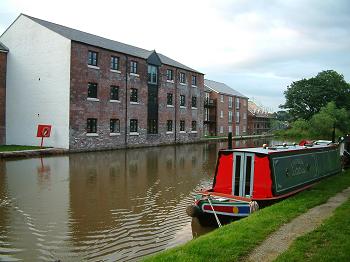
Company's warehouse at Congleton wharf. This wharf has been re-developed
and now looks better than for many years previously.
Dog Lane aqueduct
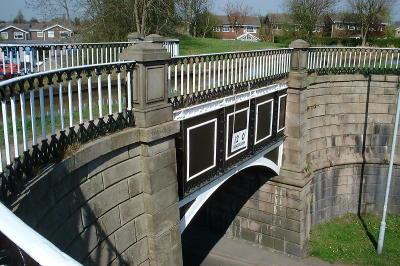
 Dog Lane aqueduct is another example of a Telford cast iron trough aqueduct supported on stone piers. The design is of simple rectangular sections of flanged cast iron panels bolted together and provided with some additional support underneath with iron arches. The whole is finished with delightful railings across the top on both sides of the canal. The name comes from the lane beside it not the road beneath it. Dog Lane aqueduct is another example of a Telford cast iron trough aqueduct supported on stone piers. The design is of simple rectangular sections of flanged cast iron panels bolted together and provided with some additional support underneath with iron arches. The whole is finished with delightful railings across the top on both sides of the canal. The name comes from the lane beside it not the road beneath it.
There was evidence of a lime kiln in the embankment beside the aqueduct but this is now impossible to see since the modern housing development was constructed.
Dog Lane aqueduct provides the best access to Congleton town centre,
about one mile down the hill. The Wharf inn is
just below the aqueduct and small general store is
just up the hill.
Congleton Wharf
 This was a Macclesfield Canal Company wharf and contained appropriate buildings to accommodate wharfage and storage. The main building has survived but only just, falling into decline and dereliction over many years. It has been rescued and restored for housing in the early 21stC. This also resulted in the entire wharf yard being covered in housing. This was a Macclesfield Canal Company wharf and contained appropriate buildings to accommodate wharfage and storage. The main building has survived but only just, falling into decline and dereliction over many years. It has been rescued and restored for housing in the early 21stC. This also resulted in the entire wharf yard being covered in housing.
Next: Scholar Green
|